Overview
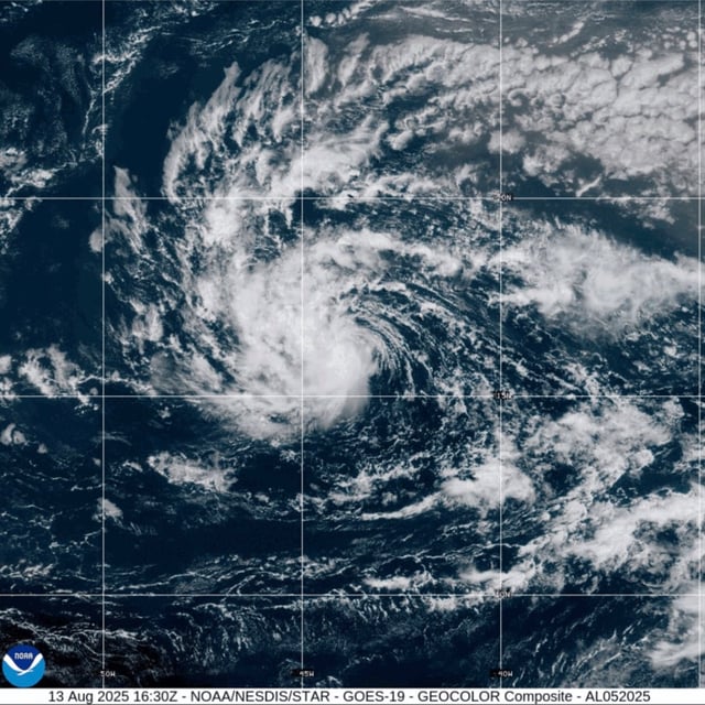
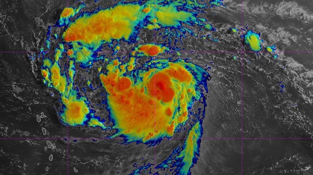
- Erin strengthened to near-hurricane force with 70 mph winds by early Friday and is forecast to reach hurricane status later in the day, with a chance of major-hurricane intensity by Sunday.
- Tropical-storm watches cover several northern Leeward Islands, including Anguilla and Barbuda, as authorities warn of heavy rain, life-threatening surf and deadly rip currents this weekend.
- Hurricane Hunter aircraft are scheduled to fly into Erin on Friday to gather in-situ data aimed at refining its intensity and track forecasts.
- Forecasters emphasize that shifts in the Bermuda High and an approaching mid-latitude trough will dictate whether Erin recurves into the open Atlantic or turns toward the Bahamas, Bermuda and U.S. East Coast.
- Erin’s precursor system caused deadly flash floods in São Vicente, Cabo Verde, prompting World Bank emergency assistance and highlighting vulnerabilities in storm-source regions.