Overview
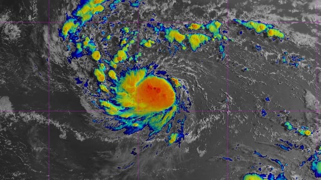
- As of the NHC’s 5 a.m. advisory on Aug. 14, Erin was about 990 miles east of the northern Leeward Islands, moving west at 17 mph with 50 mph winds and is forecast to become a hurricane Friday
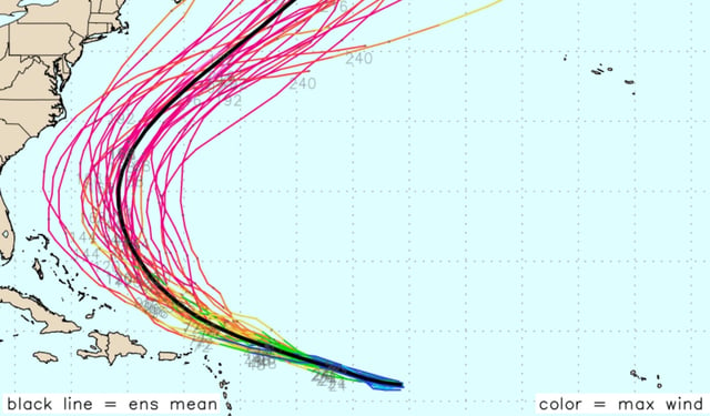
- The National Hurricane Center projects significant intensification Friday and Saturday, with Erin potentially reaching Category 3 strength (115–125 mph) before it turns north late this weekend
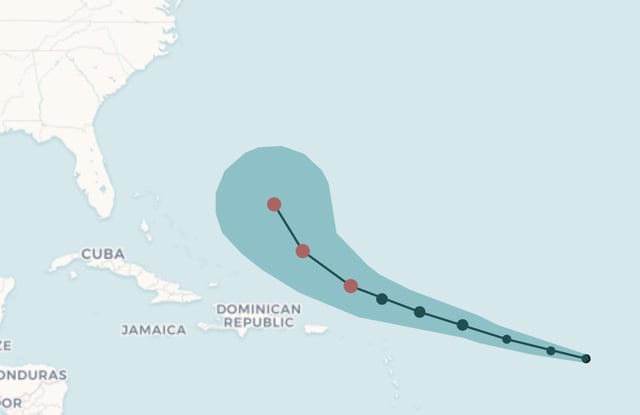
- Most high-quality forecast models show the storm recurving away from the U.S. East Coast, though the northern Leeward Islands, Puerto Rico and the U.S. Virgin Islands can expect tropical‐storm‐force winds and heavy rain this weekend
- Erin’s swells are expected to generate life-threatening surf and rip currents across the eastern Caribbean and along Atlantic beaches through next week without a direct landfall
- The NHC is also tracking a low-pressure area in the southwestern Gulf with a 20% chance of development that is forecast to move inland over northeastern Mexico by Friday, ending its formation potential