Overview
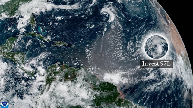
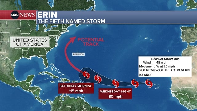
- The National Hurricane Center named Invest 97L as Tropical Storm Erin on Monday, locating it about 280 miles west-northwest of the Cabo Verde Islands with 45 mph winds and moving west at 15–20 mph.
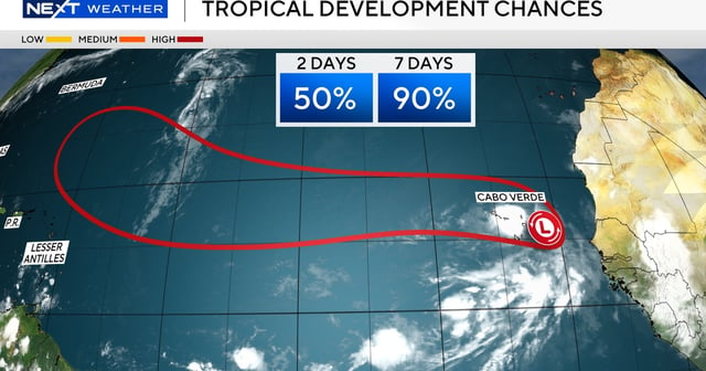
- NHC forecasts call for Erin to reach hurricane strength by Wednesday and many models project it could become a major Category 3 hurricane by this weekend as it moves through the main development region.
- Ensemble model guidance shows a likely northward recurvature into the open Atlantic, though small shifts in steering currents could alter the storm’s path and potential impacts.
- Erin is already producing heavy rain and gusty winds over the Cabo Verde Islands and is expected to generate large swells, high surf and dangerous rip currents along a broad stretch of the Atlantic basin.
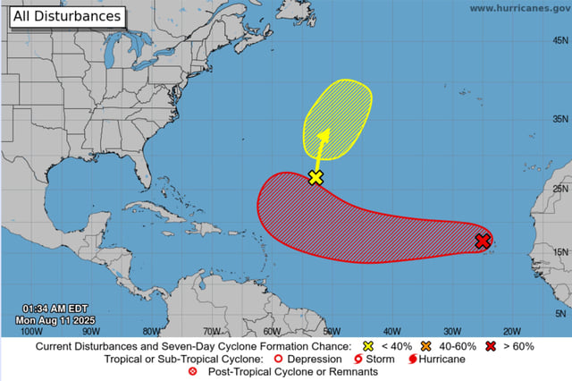
- Other Atlantic disturbances currently have low odds of development and NOAA’s outlook maintains an above-average 2025 season with 13–18 named storms anticipated.