Overview
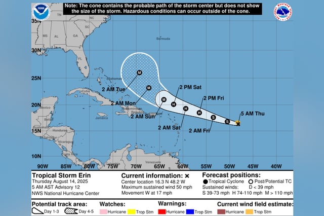
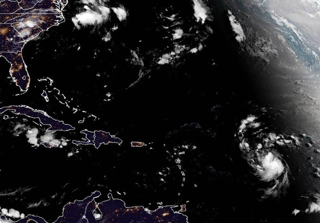
- Tropical Storm Erin is centered about 990 miles east of the northern Leeward Islands and is moving west at 17 mph with sustained winds of 50 mph as of the NHC’s 5 a.m. Thursday advisory.
- The National Hurricane Center projects Erin will reach hurricane strength by Friday and intensify to a Category 3 storm with up to 125 mph winds by early next week.
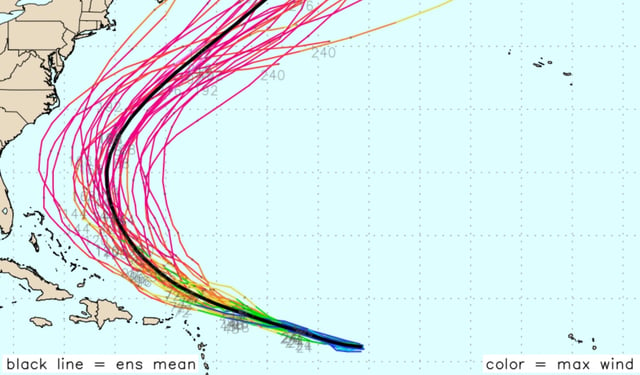
- Forecast models indicate greater-than-normal uncertainty in Erin’s track beyond the weekend, leaving potential impacts on the Bahamas, Bermuda and the U.S. East Coast unresolved.
- There are no watches or warnings in effect, but officials advise residents of the northern Leeward Islands, the Virgin Islands and Puerto Rico to monitor the storm and ready coastal preparedness plans.
- Swells generated by Erin are expected to cause life-threatening surf and rip currents along Caribbean and U.S. Atlantic beaches starting this weekend.