Overview
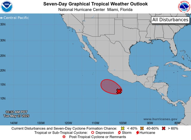
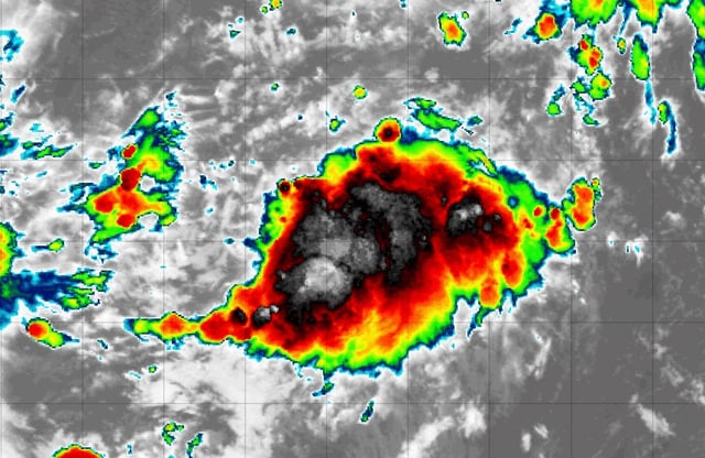
- The National Hurricane Center rates the disturbance 90–100% likely to become a tropical depression or storm within two days as it moves west-northwest at about 10 mph.
- If named, Alvin would form before the May 31 average first-storm date for the eastern Pacific, more than two weeks ahead of the historical June 10 threshold.
- NOAA’s outlook calls for a below-normal eastern Pacific season with 12 to 18 named storms, contrasting with an above-average Atlantic forecast of 13 to 19 storms, six to ten hurricanes and three to five major hurricanes.
- Gale warnings have been issued for offshore waters from Guerrero to Jalisco, where heavy rains and gusty winds are expected to accompany the system.
- The Atlantic hurricane season opens June 1, and forecasters will be watching tropical waves and warm Gulf waters for signs of early development.