Overview
- Alvin’s May 29 formation marks the earliest first named storm in the Eastern Pacific season since 2021 and nearly two weeks ahead of the average June 10 start.
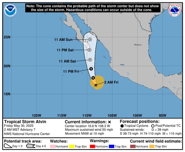
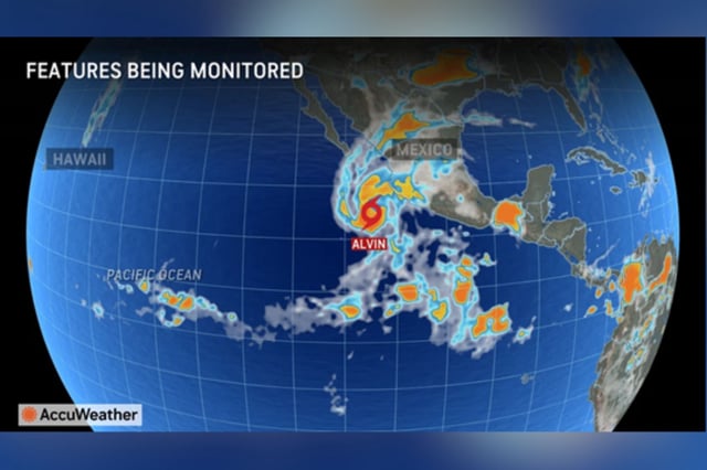
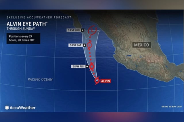
- As of Friday morning, Alvin was about 445 miles south-southeast of Baja California with maximum sustained winds near 50 mph and tracking north-northwest.
- Forecasters from the National Hurricane Center expect Alvin to weaken steadily, become a remnant low by Saturday, and avoid direct landfall.
- Large swells generated by the storm will create life-threatening surf and rip current conditions along Mexico’s west-central coast and the southern Baja Peninsula.
- NOAA’s outlook calls for a below-average Eastern Pacific season with 12–18 named storms, and Alvin’s moisture is forecast to bring rain to the drought-stricken U.S. Southwest early next week.