Overview
- Early Monday, one-hour totals reached 73.5 millimeters at Wajima’s Mitsui in Ishikawa and 53.5 millimeters in Yamaguchi City, and two men were rescued uninjured from a flooded car in Noto Town.
- The weather agency warns of a very unstable atmosphere through Monday night with threats that include landslides, lowland flooding, river rises, lightning, tornado-like gusts and hail.
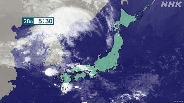
- Guidance indicates a low forming on the frontal zone over the Sea of Japan then tracking across Honshu, concentrating rain in short, intense bursts.
- Expected timing: western Japan through pre-dawn Monday, eastern Japan through morning hours, and northern Japan from pre-dawn into midday.
- Okinawa remains mostly fair under high pressure with elevated coastal waves and isolated showers or thunderstorms, while unseasonable heat persists in parts of western and eastern Japan.