Particle.news

Download on the App Store

Tornado Watch in Effect for Central and Southeast Texas Through Tuesday Afternoon

The National Weather Service warns of severe storms capable of producing large hail, damaging winds, and possible tornadoes as conditions remain favorable.

Image
Shown is an infographic describing where to seek safe shelter if you’re on the road during a tornado warning.
The High-Resolution Rapid Refresh model depicts a line of strong thunderstorms moving toward Houston early Tuesday afternoon. A tornado watch is in effect for much of Southeast Texas until 4 p.m. Tuesday.
The highlighted Texas counties, including those along the Interstate 35 corridor and in the Hill Country, is under a tornado watch until 4 p.m. Tuesday.

Overview

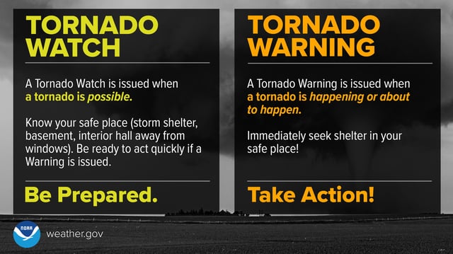
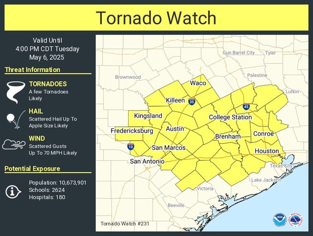
  • A tornado watch is active for Central and Southeast Texas, including the I-35 and I-45 corridors, until 4 p.m. Tuesday.
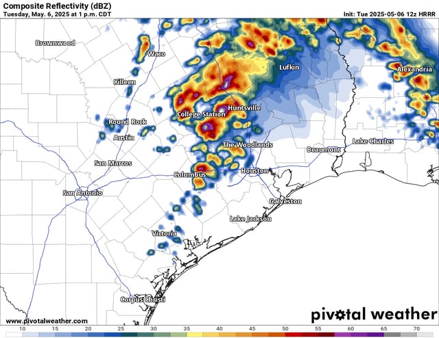
  • The watch area includes cities such as Austin, Houston, College Station, and Waco, as well as parts of the Brazos River Valley.
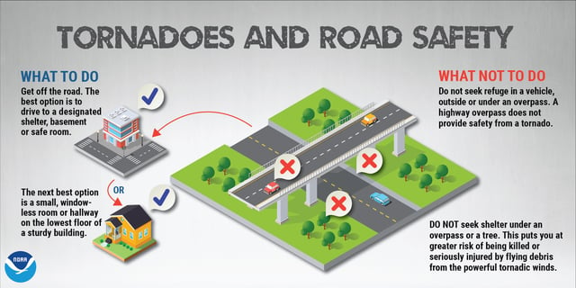
  • Scattered severe thunderstorms are expected, with potential for baseball-sized hail, 75 mph wind gusts, and isolated tornadoes.
  • A brief tornado warning near Johnson City and Marble Falls was issued early Tuesday but canceled after no tornado was confirmed.
  • Residents are advised to stay alert, monitor weather updates, and have a plan for immediate shelter if a tornado warning is issued.