Overview
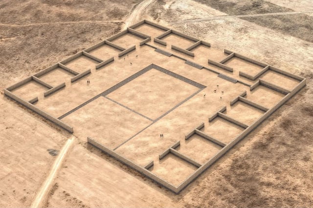
- A team led by Penn State’s José Capriles identified Palaspata roughly 215 km southeast of Tiwanaku as a modular platform temple spanning 125 × 145 m with 15 quadrangular enclosures around a sunken courtyard.
- Researchers used blended satellite imagery, UAV flights and photogrammetry to reveal the complex’s precise solar equinox alignment, indicating its ceremonial role.
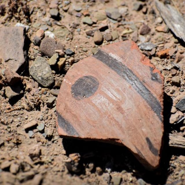
- Numerous fragments of keru cups for drinking chicha point to Palaspata’s function as a gathering place for agricultural feasts and exchange of maize from distant Cochabamba valleys.
- The temple occupies a strategic junction connecting highland Lake Titicaca, the llama-herding Altiplano and the fertile eastern valleys, highlighting Tiwanaku’s economic integration across diverse ecosystems.
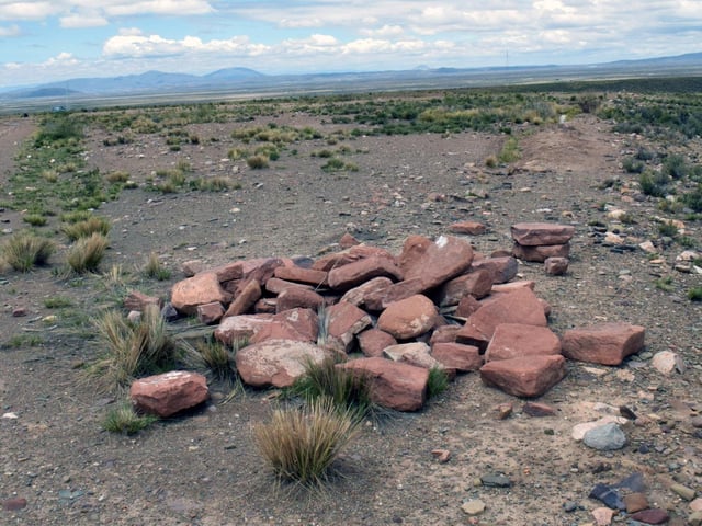
- Local, state and national authorities have initiated protective measures at Palaspata to conserve the site and develop heritage tourism in Caracollo