Overview
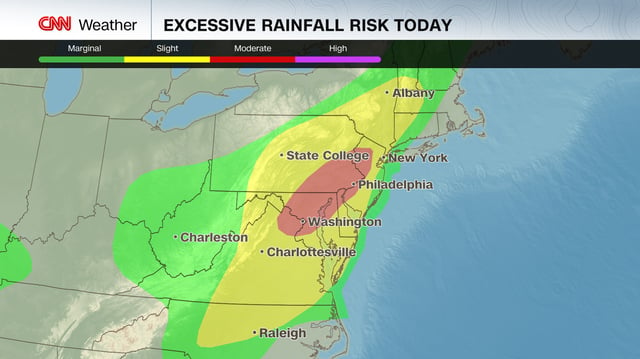
- The Weather Prediction Center has issued a Moderate Risk of excessive rainfall from July 14 to July 15 for the Mid-Atlantic I-95 corridor as a slow-moving frontal boundary taps record atmospheric moisture.
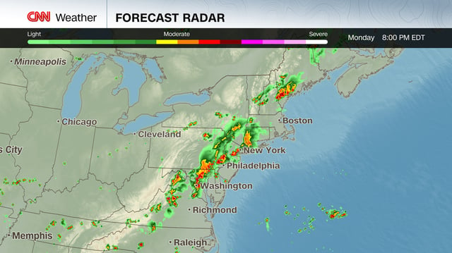
- Flood watches are in effect from 2 p.m. to midnight for northeastern New Jersey, the Lower Hudson Valley, southwestern Connecticut and New York City, where 1–3 inches of rain are expected and local totals could reach 5 inches.
- More than 44 million people across nine states and Washington, DC, are under flood watches, with over 70 million at Level 2 risk and 20 million at Level 3 risk including the DC, Baltimore and Philadelphia metro areas.
- Storms this afternoon and evening are forecast to drop 2–4 inches of rain widely and over 5 inches in pockets, threatening flash flooding in urban centers and disrupting the evening commute.
- National Hurricane Center forecaster Hagen warns that a trough off the Atlantic coast could produce heavy rain and localized flash flooding across the Florida Peninsula and north-central Gulf Coast later this week.