Overview
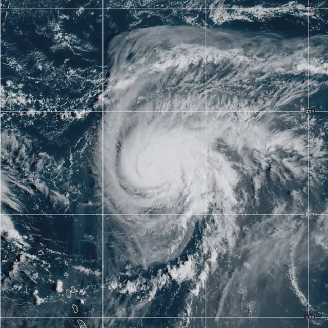
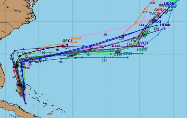
- At 0900 GMT Sunday, Tropical Depression Nine was about 100 miles west-southwest of the central Bahamas with 35 mph winds, moving north-northwest at 7 mph, and was forecast to strengthen into Tropical Storm Imelda later in the day and reach hurricane strength by late Monday or Tuesday near the Southeast coast.
- The Bahamas posted tropical-storm warnings and urged residents on the northwest and central islands to make final preparations as hurricane-hunter aircraft sampled the system and forecasters flagged heavy rain and flash-flood risk.
- North Carolina declared a state of emergency and South Carolina prepositioned search-and-rescue teams, while a tropical storm watch was posted for parts of Florida’s Atlantic coast north of West Palm Beach to north of Daytona Beach.
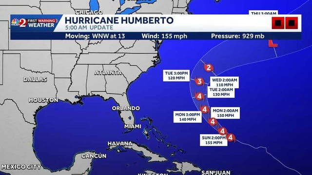
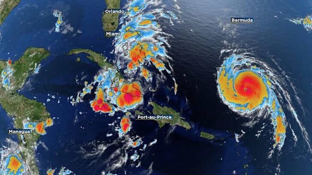
- Hurricane Humberto weakened slightly to a strong Category 4 with 155 mph winds and was positioned roughly 585 miles south of Bermuda, where a tropical storm watch could be issued later Sunday; forecasters said swells may reach the U.S. East Coast on Monday.
- Regional outlooks point to a deep plume of Atlantic moisture bringing the heaviest rain to the Carolinas and Georgia Monday night into Tuesday, with wind impacts still uncertain and some projections suggesting Humberto could later influence Imelda’s track offshore.