Overview
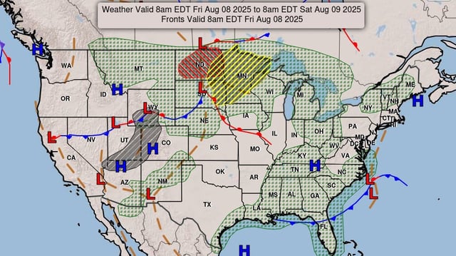
- Severe Thunderstorm Watch 579 remains in effect until 8 AM CDT across western Iowa and eastern Nebraska.
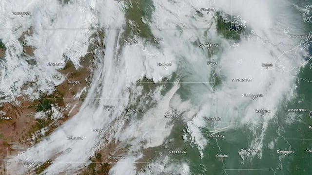
- A hybrid supercell near the Nebraska–Iowa border produced a 91 mph measured gust in Fillmore County, prompting damage reports.
- Lingering bowing line segments supported by earlier watches continue to push into Minnesota and Wisconsin with gusts of 65–80 mph.
- Mesoscale Discussion 1905 forecasts rapid storm intensification from eastern South Dakota into central Minnesota with an 80 percent probability of additional watch issuance.
- Mesoscale Discussion 1906 highlights increasing convection over northwest Kansas into south-central Nebraska capable of 1.5–2.5 inch hail and 65–80 mph gusts, with a watch potential.

