
Overview
- Temperatures run 10 to 20 degrees above normal with widespread 80s and localized near records, including Chicago near 90 degrees.
- Strong high pressure is driving sunny, dry weather, and the National Weather Service flagged elevated fire danger in the Chicago area on Sunday.
- Southerly gusts near 25 to 30 mph are forecast in parts of the Plains and Midwest, enhancing drying and affecting outdoor events.
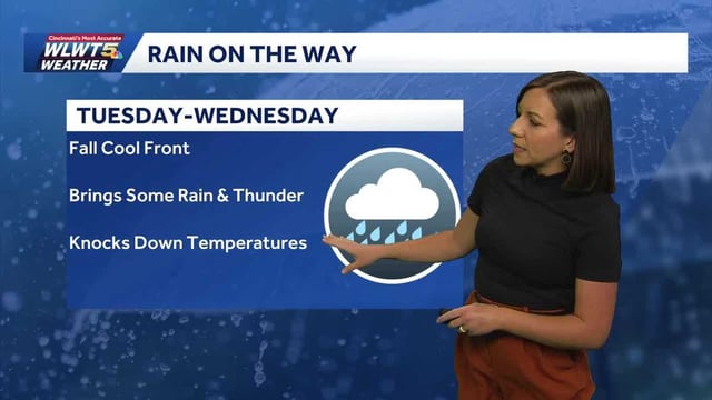
- Scattered showers arrive with the front from late Monday into Wednesday by region, with many areas expected to receive only a quarter to a half inch of rain.
- Drought persists in parts of New England as rainfall looks modest, and post-front highs drop to the 60s for many with some locations in the 50s late week.