Overview
- Much of the country stays warm today, then a sharp cool-down arrives Wednesday–Thursday with highs mostly in the 50s to 70s and inland lows dipping into the 30s and 40s with patchy frost in parts of the Northeast and New England.
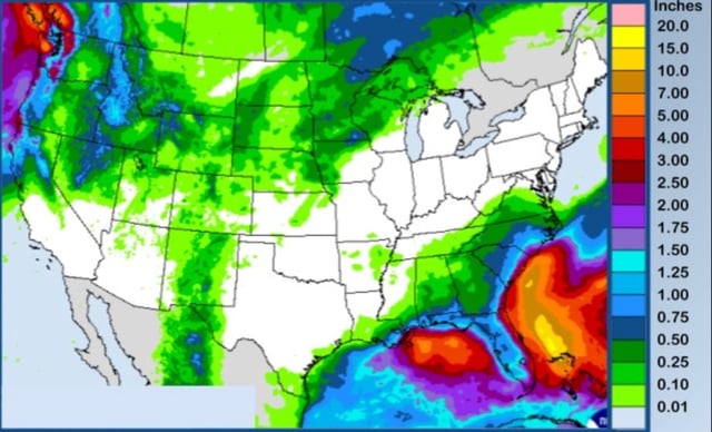
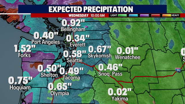
- A West Coast trough moves inland, boosting rain chances in the Pacific Northwest and Northern California, while Southern California trends dry under a deeper marine layer.
- Northern Rockies peaks, including the Absaroka and Beartooth ranges, could see the season’s first snow starting Thursday night with snow levels near 8,000–9,000 feet and a 30–50% chance of more than 6 inches in spots by the weekend.
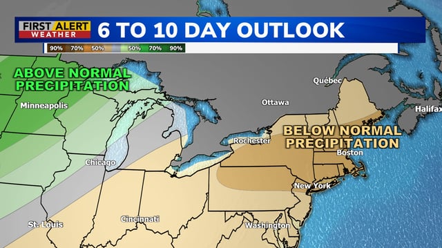
- Interior showers and isolated thunderstorms will be mostly non-severe with brief downpours and gusty winds, but many areas remain dry, prolonging drought and elevating fire danger where humidity drops.
- Offshore systems Imelda and Humberto are steering cloud cover and hazardous surf toward U.S. coasts—Beach Hazard Statements note 3–6 foot sets and strong rip currents—without delivering significant inland rainfall.