Overview
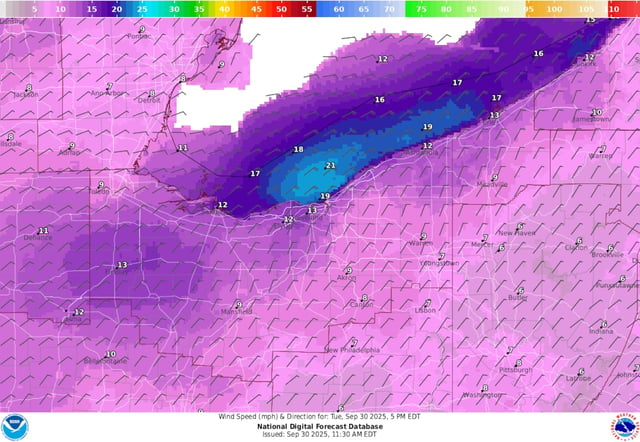
- New England and the Mid-Atlantic turn breezy and cool midweek, with highs in the 60s and patchy interior frost possible before a quick rebound to 70s and near 80 by the weekend.
- Midwest and Great Lakes forecasts call for 80s to near 90 late week into the weekend, with some near-record highs and gusty southwest winds; meaningful rain looks limited until early next week.
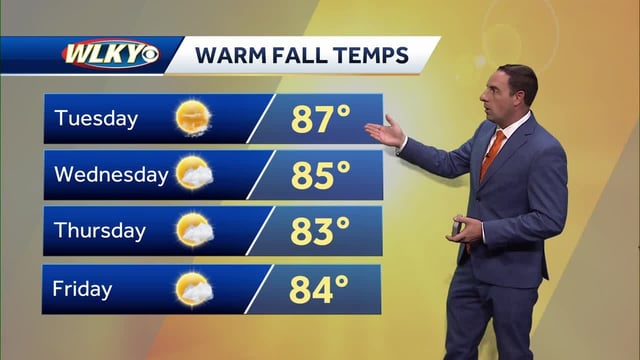
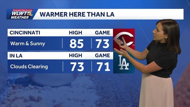
- The Ohio Valley and Plains stay warm and mostly dry through the weekend, with multiple outlets signaling little to no measurable rainfall and continued drought concerns.
- Gulf Coast markets remain hot with highs near the low 90s; a late‑week upper low could boost coastal shower chances, though many inland areas are expected to stay largely dry.
- Hurricanes Humberto and Imelda are curving northeast away from the U.S.; Bermuda faces hurricane warnings from strengthening Imelda as East Coast beaches see increased surf and rip‑current risk.