Overview
- Greer Jarrett's peer-reviewed study demonstrates that Vikings navigated open seas farther from land than previously believed.
- The research identifies a decentralized network of small island and peninsula ports that likely supported Viking trade and travel.
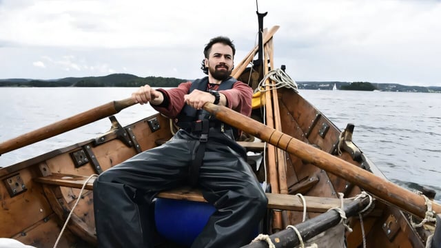
- Jarrett's team sailed over 5,000 kilometers in a replica Viking clinker boat to test its performance in authentic conditions.
- Four potential Viking 'havens' have been proposed along the Norwegian coast, awaiting archaeological survey.
- The study highlights the Vikings' use of 'mental maps' and coastal myths as key navigational tools instead of instruments like compasses.