Overview
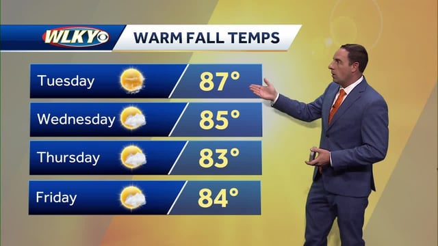
- Highs in the 80s and locally low 90s persist this week from the Midwest and Ohio Valley to the Gulf Coast, with some near-record readings forecast Friday and Saturday.
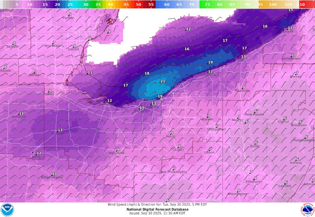
- A short, breezy cool shot drops parts of New England into the 60s Wednesday–Thursday, with northeast gusts 30–40+ mph on Cape Cod and patchy interior frost possible Thursday and Friday mornings.
- Humberto is weakening over the open Atlantic and Imelda is strengthening toward Bermuda, bringing rough surf and rip currents to the U.S. East Coast without direct land impacts.
- Temperatures rebound quickly, with the Northeast returning to 70s and near 80 by the weekend while much of the central and eastern U.S. stays unusually warm.
- Meaningful, widespread rain remains unlikely through the weekend; next week’s shower chances are uncertain, and forecasters flag worsening drought and periods of elevated fire risk in dry, breezy areas.