
Overview
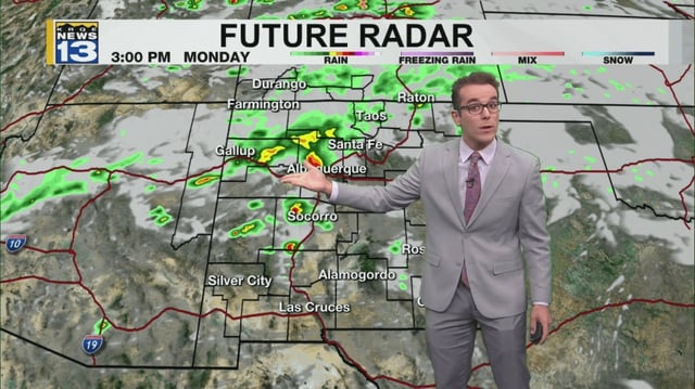
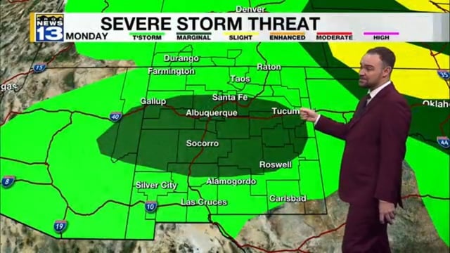
- Showers and storms are expected to build through the afternoon from the Four Corners toward Albuquerque after 1 p.m., then shift into eastern and northeastern New Mexico this evening.
- Forecasters highlight localized heavy downpours and flash‑flood potential in the west and central zones, including a small portion of Bernalillo County, with burn scars under close watch.
- KRQE notes widespread flash flooding remains unlikely, though stronger cells may produce small hail and gusty outflow winds.
- Afternoon highs run above normal, generally in the upper 70s to 80s statewide with south‑central to southeastern areas pushing into the 90s.
- A backdoor cold front tapping upper‑level moisture is expected to boost thunderstorm chances later this week and bring a midweek cool‑down, especially in the northwest.