Overview
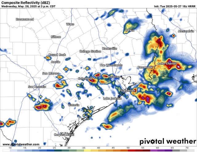
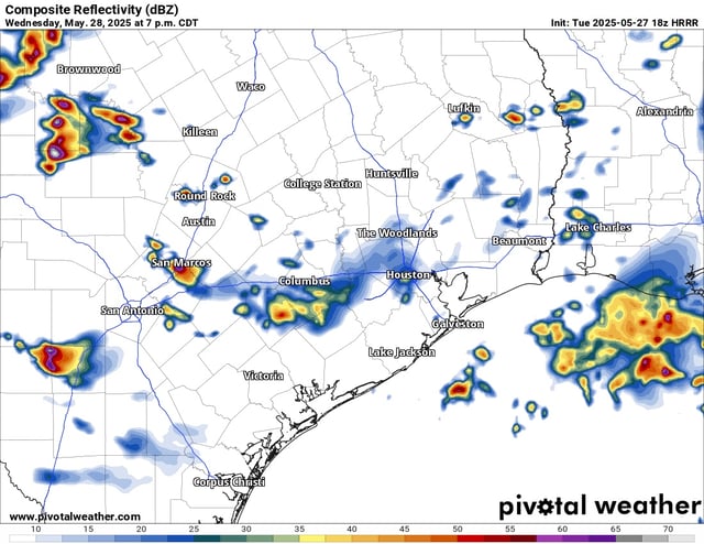
- The National Weather Service predicts continuing thunderstorms and heavy downpours in the Houston area through Friday due to a slow-moving cold front.
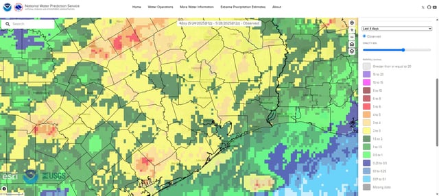
- Flood advisories remain active in Harris and Galveston counties after 2 to 4 inches of rain fell across the region earlier this week.
- Forecasters warn of localized urban flooding, damaging wind gusts and reports of small hail through Thursday morning.
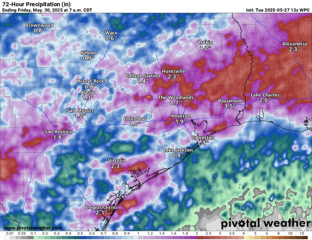
- Up to two inches of additional rainfall is possible over the next 24 hours, with pockets of Southeast Texas at risk of exceeding three inches.
- A partly sunny, mostly dry weekend is expected to offer relief just days before the Atlantic hurricane season begins on June 1.