Particle.news

Download on the App Store

Storms Ease Across Southeast Texas, Clearing Path for a Cooler, Drier Weekend

Localized flooding remains possible south of I-10 Thursday, but rain chances sharply decline heading into Mother’s Day weekend.

Houston weather forecast: Storm, hail, rainfall, possible tornadoes
The National Weather Service’s Weather Prediction Center is anticipating additional rainfall totals through Thursday morning of an inch to 2 inches, mainly along and east of Interstate 45. Higher totals are possible, especially toward Louisiana.
Shown are cumulative rainfall totals since April 30 across Southeast Texas. Dark red north of Houston indicates where 6 to 8 inches of rain have been estimated by radar. Houston and most of Harris County has received 1 to 2 inches of rain over the past seven days, while areas along the coast have picked up generally an inch to 3 inches.
Image

Overview

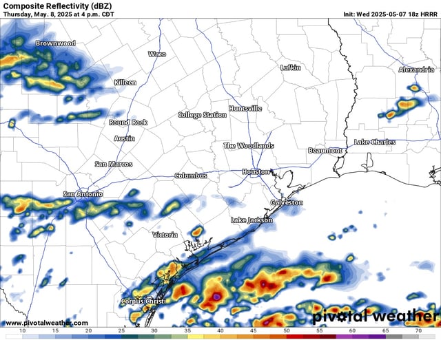
  • Heavy rainfall and severe storm risks have diminished across most of Southeast Texas, shifting southward toward coastal areas on Thursday.
  • Localized flooding remains a possibility through Thursday, especially in areas south of Interstate 10, with isolated downpours expected in coastal regions.
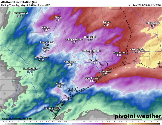
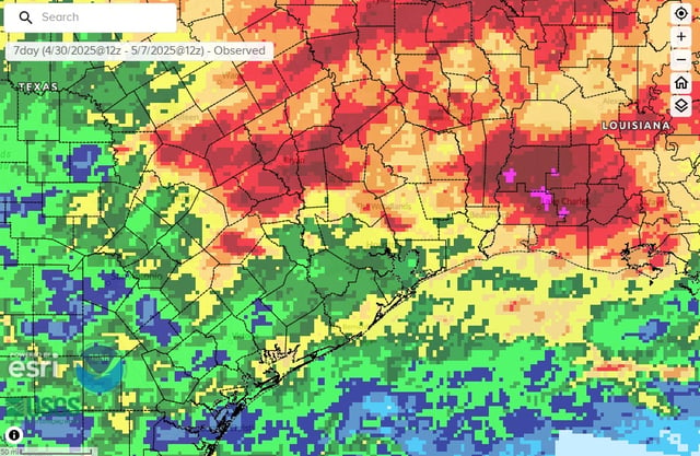
  • Rainfall totals this week reached 5–10+ inches north of Houston, with Central Grimes County recording over 10 inches, while coastal areas saw 1–3 inches.
  • Forecasts predict sunny, seasonably cool conditions for Mother’s Day weekend, with highs near 80 degrees and only a slim chance of passing showers.
  • A cutoff low-pressure system may produce isolated showers Saturday and Sunday, but no major disruptions to outdoor activities are expected.