

Overview
- Waves of rain from a lifting warm front were followed by an evening line of thunderstorms on the approaching cold front, producing widespread downpours from the Mid-Atlantic into New England.
- Localized flooding has already occurred in parts of southeastern Massachusetts, and additional pockets of 1–2 inches or more are possible where training downpours set up.
- Forecasters flagged a low-end severe risk into tonight, with isolated damaging wind gusts and a brief tornado possible in a few areas.
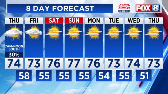
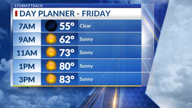
- Behind the front, drier air and slightly cooler temperatures are expected to build in Friday through the weekend, offering a more comfortable stretch for many regions.
- The National Hurricane Center is tracking Tropical Storm Humberto and Invest 94L near the Bahamas, which has a high chance of development though its track and any U.S. effects remain uncertain.