
Overview
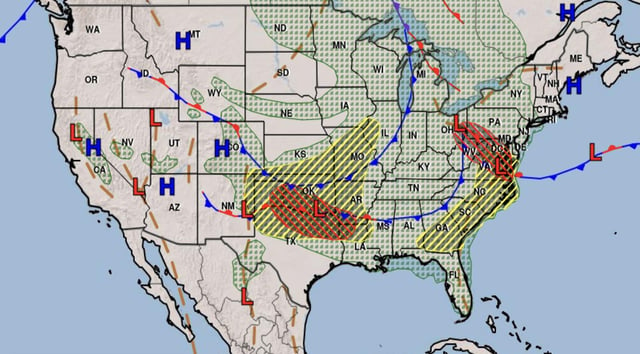
- The moderate (level 4 of 5) risk zone spans from Lawton and Wichita Falls to Dallas and Oklahoma City.
- Forecasters expect wind gusts of 80 to 100 mph, hail up to 3 inches in diameter and tornadoes through Monday.
- More than 100 million people east of the Rockies remain under threat of severe thunderstorms.
- Heavy rainfall has already triggered flash flooding in the Little Rock metro and threatens mid-South and New England communities.
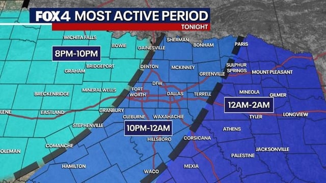
- Nighttime tornadoes carry elevated danger, and over 1.5 million residents were under tornado watches in Arkansas on June 7.