

Overview
- Météo‑France placed Aisne, Nord, Oise, Pas‑de‑Calais, Seine‑Maritime and Somme on orange alert from midday, forecasting 100–120 km/h gusts on the Channel coast locally up to 130 km/h and 90–110 km/h inland, with an easing expected in the evening.
- Ireland and the UK saw severe impacts on Friday, including a death in Donegal, gusts measured up to 148 km/h, about 184,000 Irish customers without power, 58 flights canceled at Dublin, rail suspensions, and roughly 50,000 outages in Northern Ireland.
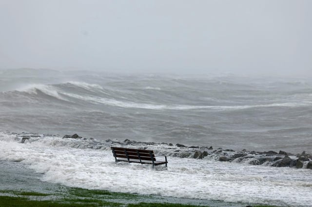
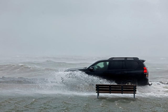
- Forecasters warn of very rough seas, with waves of 10–12 meters off Scotland and 3–4 meter swell in the English Channel creating a risk of coastal flooding and submersion.
- A cold front tied to Amy is crossing France west to east on Saturday with rain and squally showers in the north, and early damage was reported in the Somme where high winds tore open a house as several Hauts‑de‑France rail lines were halted.
- Meteorologists describe Amy as an explosive cyclogenesis event with pressure dropping more than 40 hPa in 24 hours, and they expect calmer conditions to return on Sunday after today’s peak winds.