


Overview
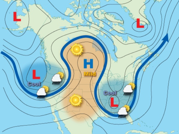
- A slow-moving storm system, anchored by an Omega Block, is bringing severe thunderstorms, flash flooding, and fire risks to the Plains and the South through Wednesday.
- Flood watches are in effect for northern New Mexico and the Texas and Oklahoma panhandles, while red flag warnings persist in parts of Arizona, New Mexico, and the northern Plains.
- The Storm Prediction Center has elevated severe weather risks in West Texas and the Panhandle, warning of hail over 2 inches in diameter, damaging winds, and isolated tornadoes, especially near Lubbock and Fort Stockton.
- Flash flood concerns are significant across Southeast Texas, Louisiana, and Mississippi, with rainfall totals of 1–3 inches forecast and higher amounts possible near Beaumont.
- The Omega Block pattern, an unusual atmospheric setup, is prolonging storm impacts and compounding risks in areas already saturated or prone to drought.