

Overview
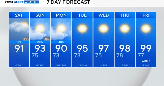
- The stalled front ended a three-day stretch of triple-digit highs, dropping daytime temperatures into the mid-90s with heat indices near 105°F.
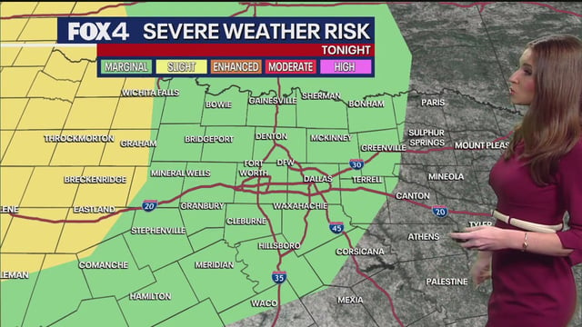
- The National Weather Service Weather Prediction Center has issued a Level 2 of 4 flash-flood risk for areas north of I-20 and east of I-35 through early Sunday.
- Afternoon and overnight storms are expected to produce heavy rain, gusty winds and frequent lightning despite no severe weather outlook.
- The Climate Prediction Center’s 6-10 day outlook gives North Texas a 60-70% chance of above-normal temperatures from August 5-9 and a 50-60% chance from August 7-13.
- A ridge of high pressure is expected to build by Tuesday, restoring dry conditions and pushing highs back toward 100°F by week’s end.