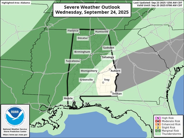
Overview
- North and much of west Alabama face a marginal risk today, with south and east Alabama under a similar risk on Thursday.
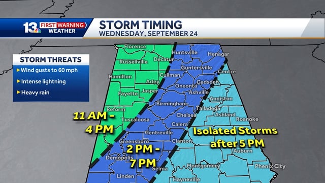
- The National Weather Service cites damaging wind gusts up to about 60 mph, heavy rain, intense lightning, and small hail as the main hazards.
- Tornadoes are not expected in this setup according to both SPC outlooks and NWS guidance.
- A broken line of storms is expected to move in this afternoon and evening, with another round redeveloping early Thursday that may affect morning travel in central and southern areas.
- Storms should exit Thursday night as a cold front brings a brief cool-down for the weekend before a warming trend returns early next week.