Overview
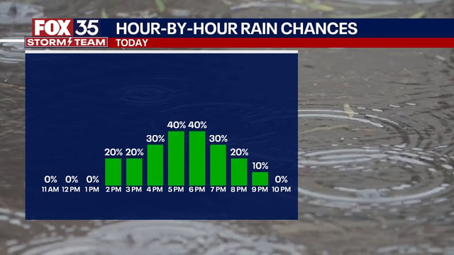
- Scattered showers and thunderstorms are expected this afternoon and early evening, with brief heavy downpours that could cause localized flooding.
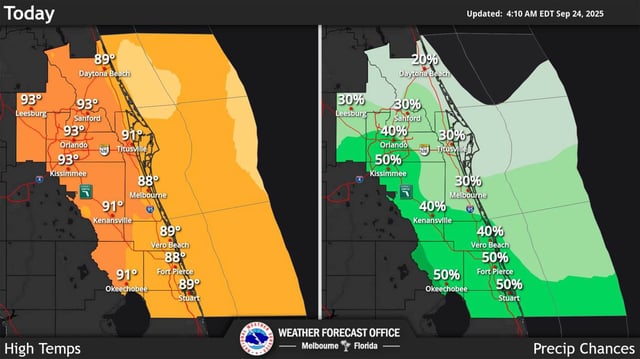
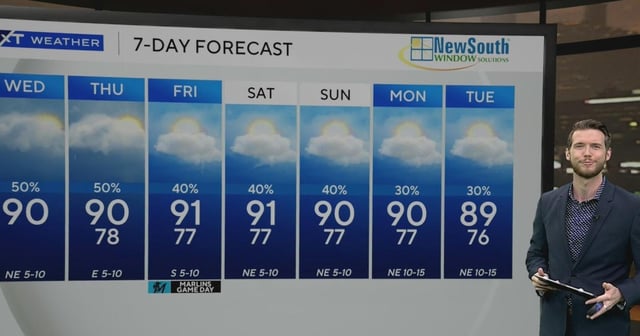
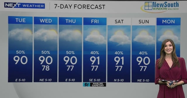
- Highs will reach the upper 80s to low 90s and the heat index will push into the upper 90s to near 100.
- Two tropical waves east of the Leeward Islands carry medium to high development odds but are projected to remain east of Florida.
- The National Weather Service expects a surface front and upper-level trough to steer any development away, though added moisture could boost rain later this week.
- A moderate rip-current risk persists along Atlantic beaches, no marine advisories are posted for Atlantic or Keys waters, and a front may stall near Lake Okeechobee this weekend to keep the pattern unsettled.