
Overview
- Waves of showers and thunderstorms continue into tonight from the Mid-Atlantic to New England, with most spots receiving about 0.25–1 inch and localized 1–3 inches, and “extreme flooding” closing a Route 24 exit in Fall River, Massachusetts.
- The main window for stronger storms runs from afternoon into evening, bringing a low-end risk for damaging wind gusts, very heavy downpours or a brief tornado.
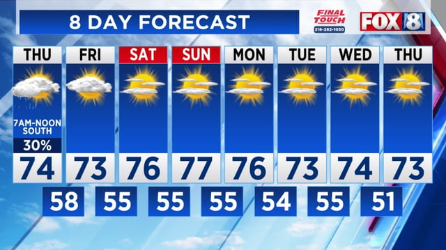
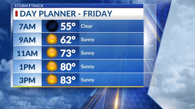
- Rain tapers and the front shifts offshore on Friday, opening a stretch of sunnier, less humid weather through the weekend as high pressure builds.
- The National Hurricane Center reports Tropical Storm Humberto strengthening in the western Atlantic and Hurricane Gabrielle moving through the Azores.
- A disturbance near the Bahamas has a high chance to develop into the next named storm within days, though any potential effects on the Southeast or East Coast next week remain uncertain.