
Overview
- Over 200 active Canadian wildfires have burned more than 8.6 million acres across Central and Western Canada.
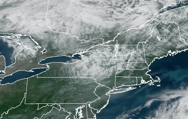
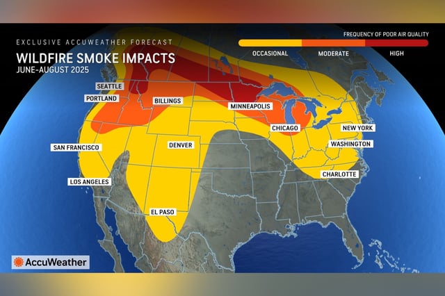
- Smoke plumes have drifted into the western and northern United States, reducing visibility from the Pacific Northwest through the Midwest and reaching New England.
- Health officials warn that inhaling wildfire smoke can trigger acute respiratory issues and exacerbate asthma and chronic obstructive pulmonary disease, prompting air quality alerts for sensitive groups.
- Smoke altitude in the atmosphere determines its impact on ground-level air quality, with higher plumes often remaining aloft until weather systems mix them downward.
- Meteorologists forecast weekend rain in western and central Canada to slow fire growth and offer temporary relief from cross-border smoke.