

Overview
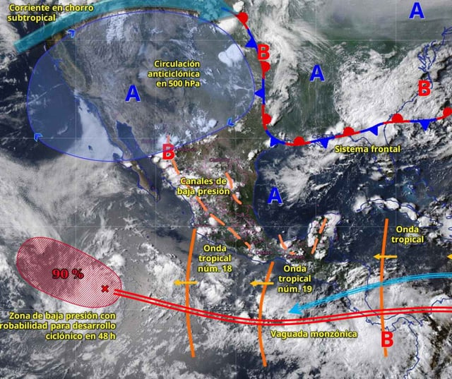
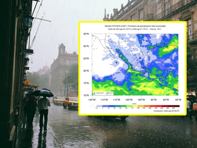
- SMN predicts 50–75 mm of rain on Monday in Michoacán, Guerrero, Oaxaca and Chiapas as Tropical Wave 19 tracks along the Pacific coast.
- Tropical Wave 20 will draw Caribbean moisture over the Yucatán Peninsula on Monday and drive heavy showers into southern states on Tuesday.
- Accumulations of 75–150 mm are expected in Guerrero, Oaxaca, Chiapas and Veracruz, raising the threat of floods and landslides.
- Coastal and mountainous areas will face gusts up to 60 km/h and swells of 1–2 meters, while temperatures in Baja California and Sonora exceed 45 °C.
- Conagua has issued flood, landslide and high-wave alerts and advises residents to stay informed, avoid vulnerable zones and prepare for possible evacuations.