

Overview
- Severe thunderstorm warnings are active in parts of Northeast Ohio, with wind gusts up to 60 mph and hail reported in some counties.
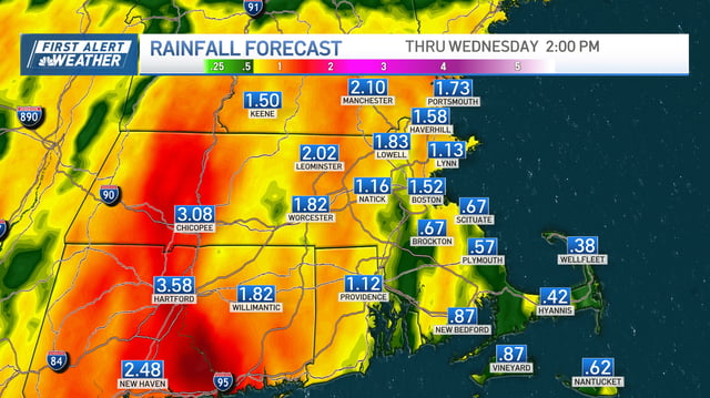
- Additional rainfall of 0.5 to 1.5 inches is expected through Tuesday in Ohio, while parts of New England could see up to 4–5 inches, prompting flood watches.
- Dense fog advisories expired Monday morning in Northeast Ohio, but visibility issues may persist in some areas overnight into Tuesday.
- The Storm Prediction Center has placed parts of Ohio under a slight to marginal risk for severe weather, including strong winds and isolated tornadoes.
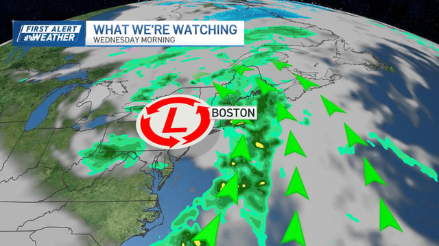
- The system is forecast to exit by midweek, with drier and warmer conditions anticipated starting Thursday across affected regions.