


Overview
- A slow-moving frontal system will linger over Northeast Ohio for the next 48 hours, producing persistent showers and scattered thunderstorms.
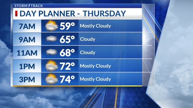
- Rain is forecast to begin late Thursday morning and ramp up into more consistent storms late Thursday night into Friday morning.
- The heaviest precipitation is expected along and south of US-30, where slow-moving storms could trigger localized flooding.
- Daytime highs will be about 10 degrees cooler than Wednesday, reaching the mid- to upper-70s.
- Humidity is slated to fall heading into the weekend, and temperatures are expected to remain below average into next week.