
Overview
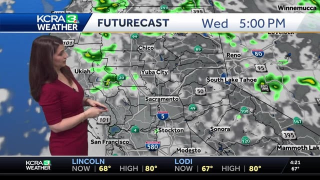
- Thursday brought an Impact Day in the Sierra, with slow-moving thunderstorms capable of heavy downpours, lightning, small hail or graupel, and localized flooding in steep terrain.
- Radar estimates showed higher terrain pockets picking up more than a half-inch to over an inch of rain in the past 24 hours, while the Sacramento Valley stayed largely dry and cool.
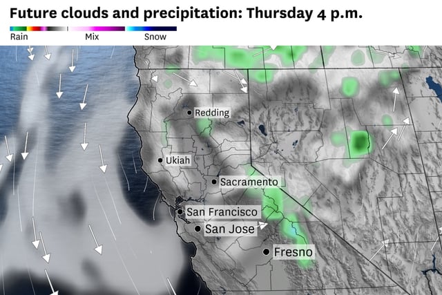
- The upper-level low shifts east, leaving only isolated mountain sprinkles by Thursday evening and setting up fair weather clouds but dry conditions in the Sierra on Friday.
- Temperatures rebound Friday and Saturday, with valley highs rising to the upper 80s to near 90 degrees and Lake Tahoe areas climbing toward the 70s after a cold start.
- A fast-moving system may clip the region Sunday, bringing a noticeable breeze and only limited shower chances, as the National Weather Service reiterates standard thunder safety guidance.