

Overview
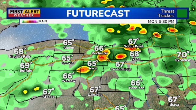
- Forecasters expect multiple rounds of rain and thunderstorms from the Midwest and Ohio Valley to the Northeast, with the most organized rainfall generally Tuesday through Thursday.
- The National Weather Service maintains a marginal (level 1 of 5) severe risk in some areas, with isolated damaging gusts and small hail the primary hazards.
- Projected rainfall of roughly 1 to 3 inches is common in local forecasts, with higher pockets possible in heavier downpours, including parts of Kentucky, Indiana, Ohio and Michigan.
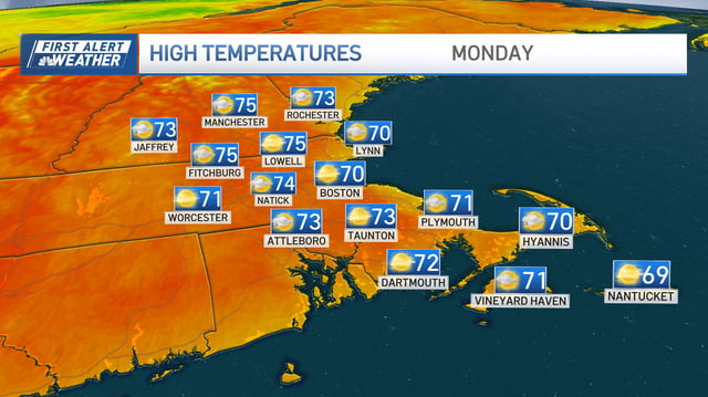
- Temperatures ease back toward seasonable levels, with many locations holding in the upper 60s to mid‑70s as the unsettled pattern replaces the recent hot, dry stretch.
- Subtropical moisture could enhance showers in Southern and Central California early this week, and forecasters note model uncertainty tied to tropical influences along the Atlantic.