
Overview
- KOAA forecasts wind gusts of 40–50 mph on Sunday, strongest over higher elevations and the eastern plains where travel and outdoor conditions could be hazardous.
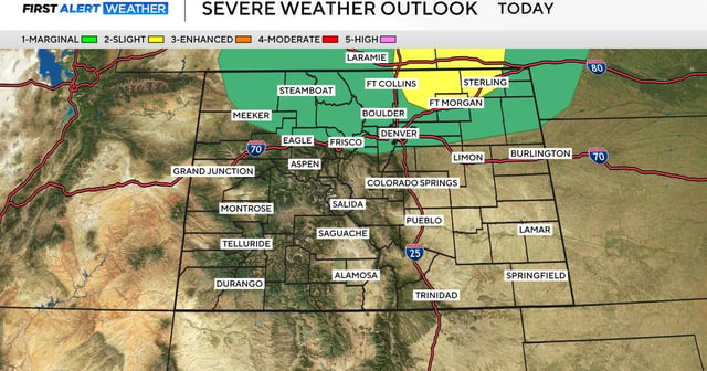
- Scattered showers are expected to reach the I-25 corridor around 1 p.m. Sunday and spread onto the plains by evening before clearing overnight.
- Colorado Springs is projected to reach about 78°F with gusts near 40 mph, while many plains locations run in the 80s ahead of the passing disturbance.
- Saturday remains warm and breezy with gusts near 30 mph, isolated late-day showers or storms possible, and a light dusting of snow on the highest peaks.
- Conditions are expected to settle later Sunday in southern Colorado, while the Denver area trends cooler into the 60s with a chance of evening showers mainly north of I-70 and broader rain chances returning Tuesday and Wednesday.