


Overview
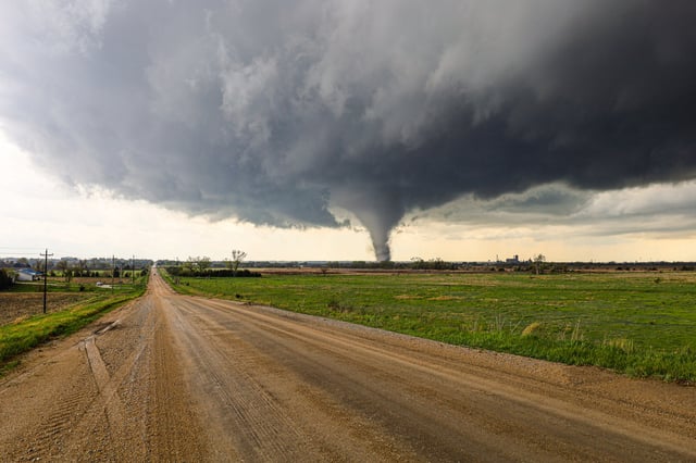
- The Storm Prediction Center has issued a Moderate Risk (level 4 of 5) for severe thunderstorms in southern Minnesota, northern Iowa, and western Wisconsin.
- Tornado watches are in effect for parts of southwestern Minnesota and northwestern Iowa until 8 p.m. local time, with further watches anticipated as storms progress eastward.
- Forecasters predict two waves of storms Monday, with the late afternoon and evening round posing the highest risk of EF2 or stronger tornadoes, large hail, and damaging winds.
- Authorities in Minneapolis have closed public facilities, activated emergency operations centers, and urged residents to finalize preparedness plans, including securing outdoor items and charging devices.
- The storm system will continue moving eastward through Wednesday, bringing heavy rain and flash flooding risks to areas from Texas to southern Missouri.