
Overview
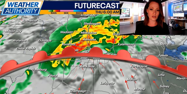
- A stalled cold front south of Northeast Ohio is bringing a return of warmth and moisture, raising the risk of severe weather Thursday.
- The Storm Prediction Center has placed much of Ohio under a Level 2 slight risk for severe storms, with damaging winds as the primary threat.
- Showers and storms will begin late Thursday morning, with additional rounds possible into the evening and overnight hours.
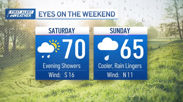
- Friday will see lingering showers and scattered storms, followed by a surge of cooler air Friday night into Saturday, dropping highs into the upper 50s.
- Forecast models differ on whether rain will persist into the weekend or if colder, drier air will dominate after Saturday.