Overview
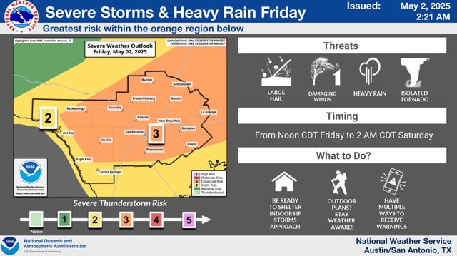
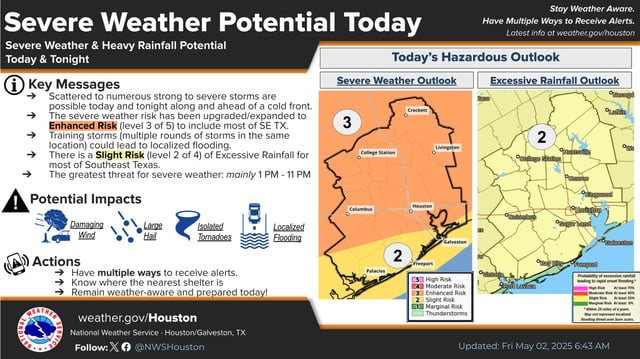
- The Storm Prediction Center has placed Southeast Texas, including Houston, under a Level 3 out of 5 enhanced risk for severe weather on Friday.
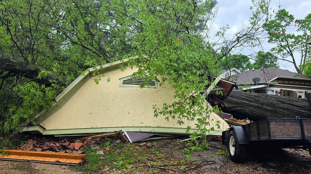
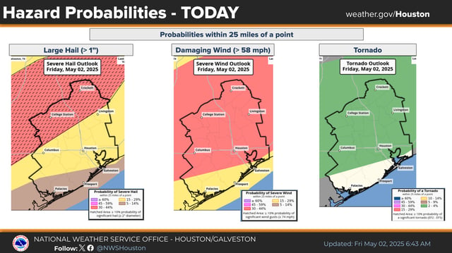
- The most significant storm activity is expected between 1 p.m. and 11 p.m., with large hail up to 2 inches possible in the afternoon and damaging wind gusts up to 60 mph in the evening.
- Localized flash flooding is a concern north of Houston, particularly in areas affected by training storms, which could bring an additional 1 to 2 inches of rain on already saturated ground.
- Houston’s flood risk remains limited due to minimal rainfall earlier in the week, though minor flooding may occur in flood-prone areas with poor drainage.
- The cold front is forecast to push offshore by midnight, with lingering showers tapering off into Saturday morning, followed by drier conditions.