Particle.news

Download on the App Store

Severe Storms Sweep Through North Texas, Rare April Snowfall Expected in Panhandle

A strong spring weather system brings hail, tornado risks, and unseasonable cold as it moves southward across Texas this week.

Shown are the expected high temperatures across Texas on Wednesday afternoon, left, along with the potential future weather radar image overnight at 1 a.m. Thursday.
Shown are the severe storm outlooks for overnight Thursday, left, as well as overnight Friday into Saturday from the National Weather Service’s Storm Prediction Center.
Shown are the potential cumulative rainfall totals across Texas through Saturday. The highest rainfall totals are expected in the northern half of the state.
Future weather radar modeling shows rain transitioning to snow across the Texas Panhandle at 10 a.m. Saturday as an arctic cold front stretches across the western half of the state. 

Overview

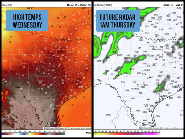
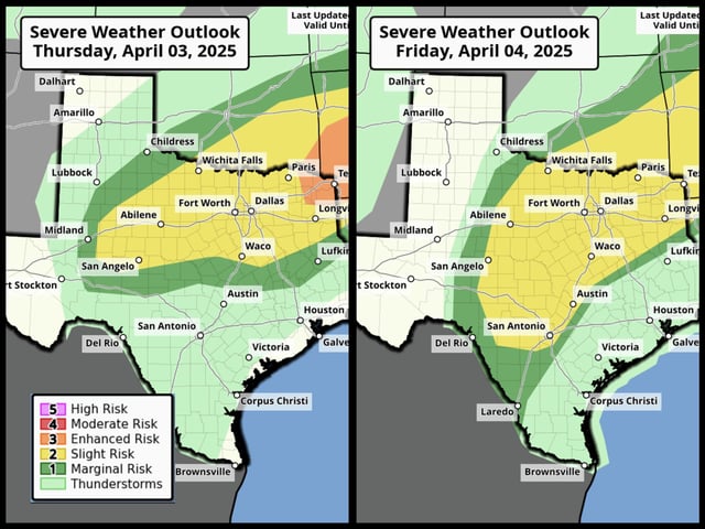
  • Severe thunderstorms impacted North Texas, including Dallas and Fort Worth, with hail and tornado risks reported Wednesday night.
  • The storm system is shifting southward, increasing severe weather chances in Central Texas, including San Antonio, by Friday night.
  • A strong cold front on Saturday will bring rare April snowfall to the Texas Panhandle, with Amarillo and Lubbock expecting 1 to 3 inches of accumulation.
  • Temperatures will drop sharply across the state, with lows in the 40s and highs in the 60s expected in South and Southeast Texas by Sunday.
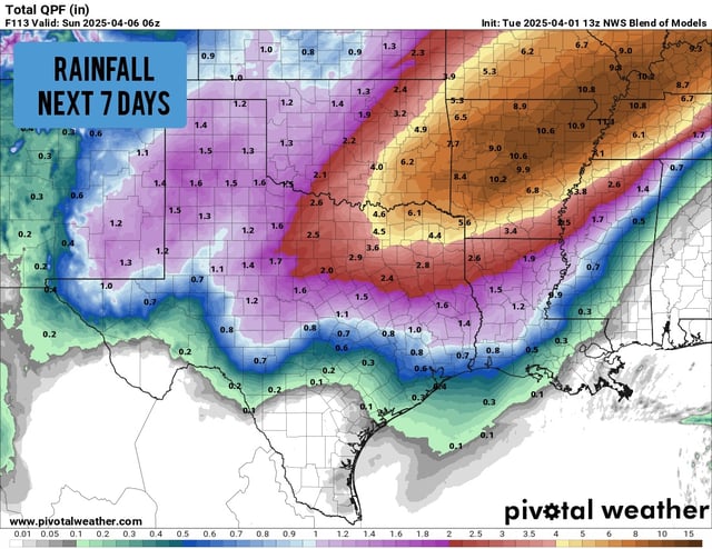
  • Houston remains mostly dry through Thursday, but storms could reach the area on Saturday as the cold front progresses.