
Overview
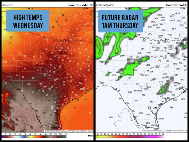
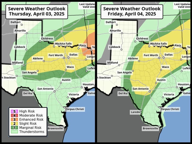
- The National Weather Service has placed cities like Dallas, Fort Worth, and Sherman under a level 3 of 5 risk for severe thunderstorms Wednesday night.
- The atmospheric cap inhibiting storm development is eroding, allowing strong storms to form in North Texas, with threats including hail over 2 inches, wind gusts over 75 mph, and isolated tornadoes.
- Central and South Texas, including San Antonio, are expected to see isolated severe storms develop late Thursday into Friday as the cold front moves southward.
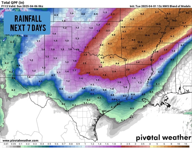
- A strong cold front on Saturday will bring significant temperature drops statewide, with highs falling into the 60s and lows into the 40s, and rare snow possible in the Texas Panhandle.
- Travel delays are anticipated for flights out of Dallas and Houston due to widespread severe weather, particularly for routes toward the Midwest.