Overview
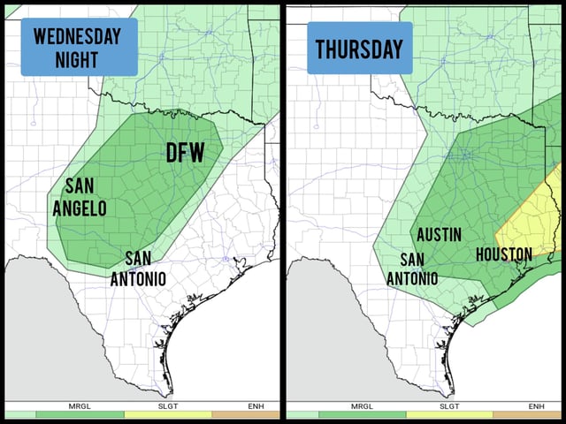
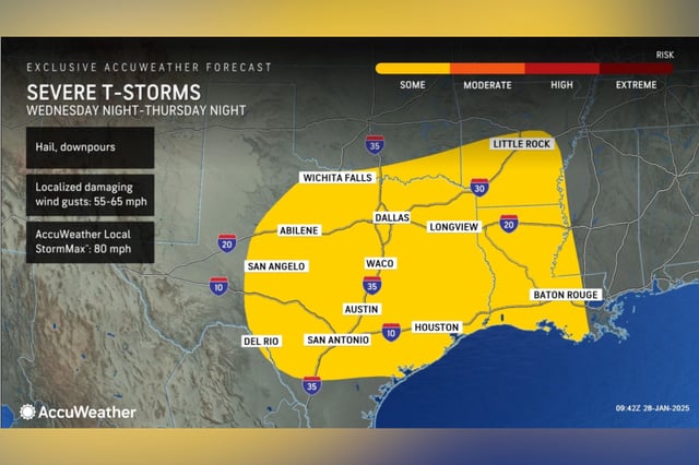
- Forecasters predict a strong weather system will bring thunderstorms to Texas starting Wednesday night, moving eastward through Thursday evening.
- Houston and parts of Southeast Texas are under a Level 2 severe weather risk for Thursday, with potential threats including damaging winds, large hail, and isolated tornadoes.
- Rainfall totals of 1 to 3 inches are expected across the region, raising concerns about localized flash flooding, particularly in urban areas with poor drainage.
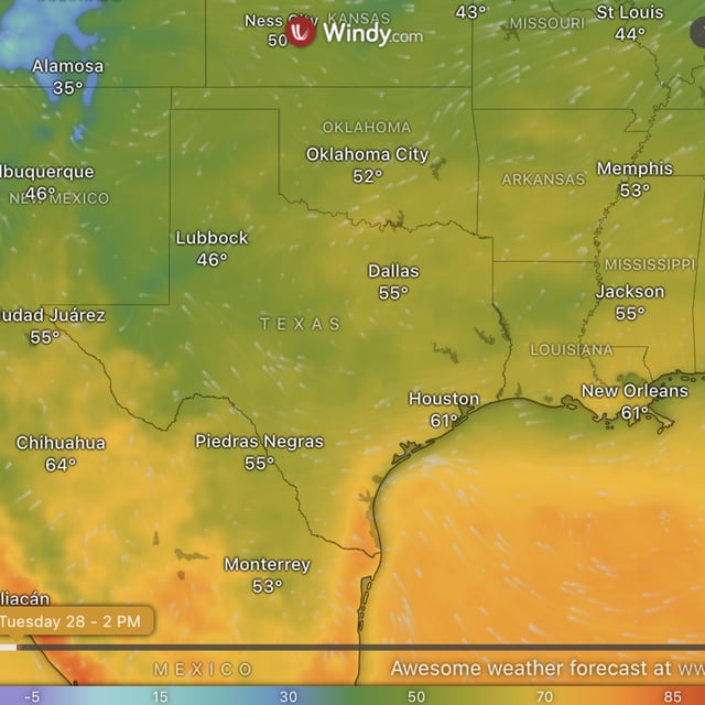
- The storms are fueled by Gulf moisture and atmospheric instability, with the strongest activity likely to develop along the I-35 corridor Thursday morning before reaching Houston by the afternoon.
- Temperatures will drop slightly after the cold front passes, leading to a sunny and mild weekend with highs in the lower 70s.