Overview
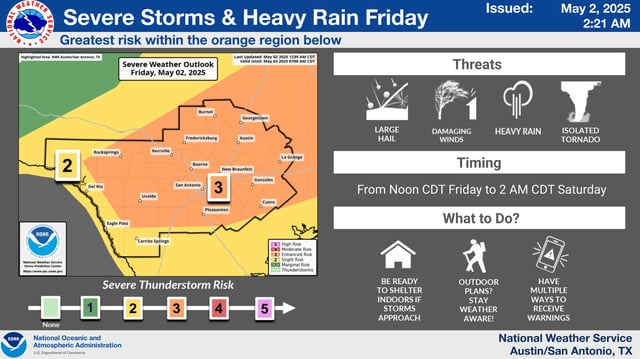
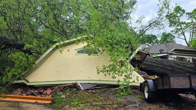
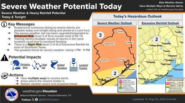
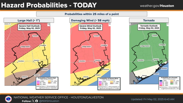
- A slow-moving cold front on Friday caused severe thunderstorms across South and Southeast Texas, producing large hail, damaging winds, and isolated tornado warnings.
- The National Weather Service issued an Enhanced Risk warning for much of the region, including major cities like Houston and San Antonio, highlighting the elevated threat level.
- Localized flash flooding was reported as storms brought 1-2 inches of rain, with isolated areas receiving up to 3-4 inches overnight.
- A brief tornado warning was issued for Harris and Liberty counties Friday afternoon, with hail reported in several areas, though no significant damage was recorded.
- As of Saturday midday, severe weather watches and warnings have expired, with drier and cooler conditions expected for the rest of the weekend.