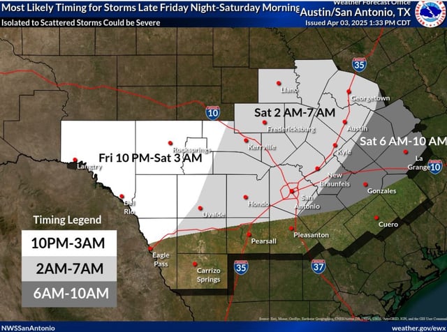
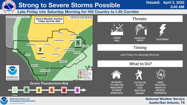
Overview
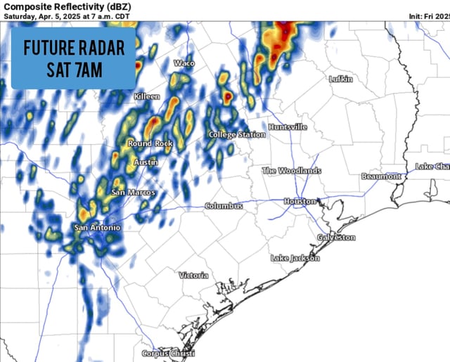
- South and Central Texas are under a Level 2 severe weather risk, with the strongest storms expected overnight into Saturday morning, particularly between 1 a.m. and 7 a.m.
- Large hail, with some reports suggesting sizes up to baseballs, and wind gusts up to 70 mph are the primary threats associated with the storms.
- A tornado watch has been issued for areas northeast of San Antonio, though the overall tornado threat remains low across the region.
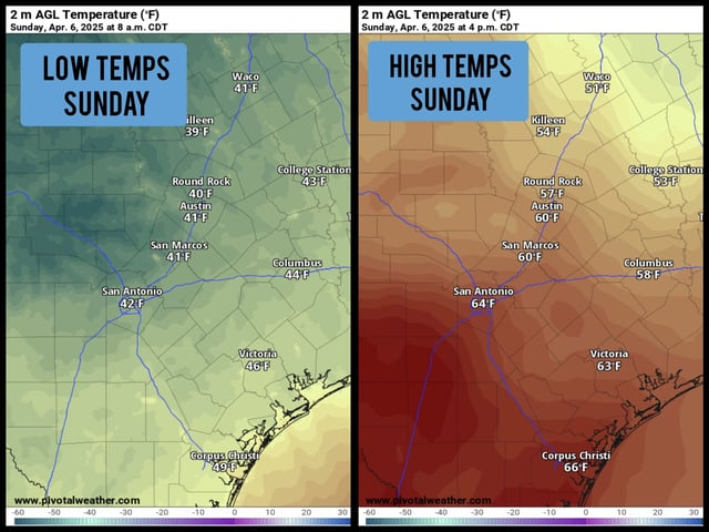
- A strong cold front will move through the area on Saturday, bringing significantly cooler temperatures, with lows dropping into the low 40s by Sunday morning and wind chills in the mid-30s.
- Temperatures will remain below average on Sunday, peaking in the mid-60s, before a warming trend begins early next week, with highs near 80 degrees by Tuesday.