Overview
- Severe Thunderstorm Watch 580 remains in effect across western and central Iowa through noon CDT Saturday, with ongoing clusters capable of 70–80 mph gusts and isolated hail up to 1.5 inches.
- SPC Mesoscale Discussion 1913 highlights the likelihood of another watch later today as storms develop over eastern Colorado, western Kansas and southwest Nebraska with risks of large hail, damaging winds and isolated tornadoes.
- The multi-day outbreak has shifted eastward from the Northern Plains into the Upper Midwest, evolving from discrete supercells into bowing segments and mesoscale convective systems.
- Earlier rounds since August 7 produced wind gusts near 90 mph and hail up to 3 inches, underscoring the potency of successive severe weather episodes.
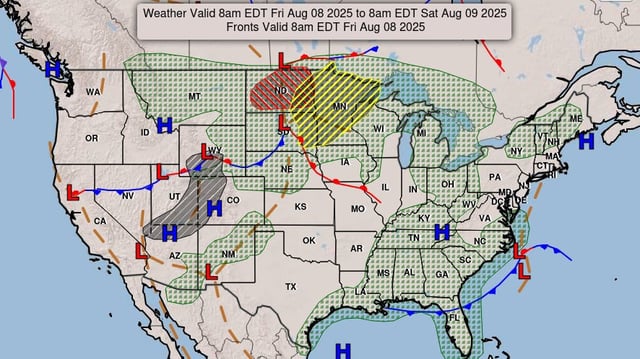
- A potent upper‐level shortwave trough, strong low‐level warm advection and high CAPE under steep lapse rates have fueled repeated rounds of severe storms across the region.