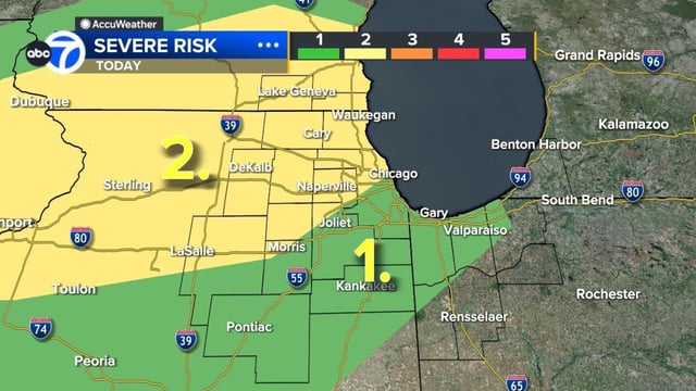


Overview
- The watch covers Cook, DuPage, Kane, Kendall, Grundy, Lake, LaSalle, McHenry and Will counties through 6 p.m.
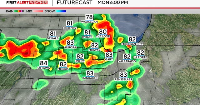
- Early storm cells are moving into northwest Indiana while additional clusters develop to the region’s northwest.
- Gusty winds could hit 70 mph, hail up to roughly quarter-inch in diameter and brief tornadoes remain possible under the issued watch.
- Showers and thunderstorms are expected to continue into the night before tapering off by Tuesday morning.
- A shift to partly sunny skies with highs in the mid-80s on Tuesday precedes a cooler midweek with temperatures near 80°F.