Overview
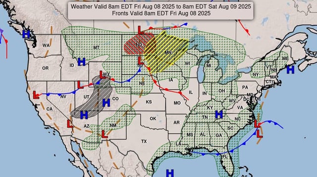
- Severe Thunderstorm Watch 582 is in effect from 8:45 PM Saturday to 4:00 AM CDT Sunday for southwest Iowa, western and northern Kansas, and southern Nebraska.
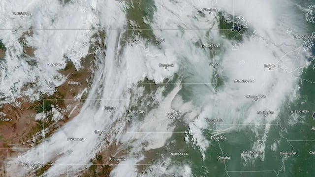
- Clusters of storms tracking from northeast Colorado into Kansas and Nebraska have produced damaging wind gusts up to 80 mph, hail up to 2 inches in diameter and isolated tornado potential.
- SPC mesoscale discussions indicate additional storm development across northern Kansas into southern Nebraska with severe hail and wind threats extending east overnight.
- Flash flood potential is shifting northward into parts of Minnesota and Wisconsin as heavy rain bands associated with the outbreak move into the Upper Mississippi Valley.
- More than 40 million people across the central U.S. remain under heat advisories with heat indices reaching 100–110 °F through Sunday.