Overview
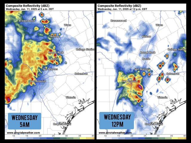
- The National Weather Service has issued a severe thunderstorm warning for the San Antonio metro area, with quarter-sized hail, 60 mph winds and torrential rainfall expected overnight.
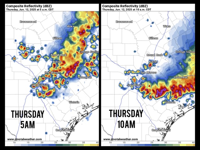
- A Level 2 out of 5 slight risk for severe storms covers the Houston region today, where damaging wind gusts, isolated tornadoes and street flooding are possible.
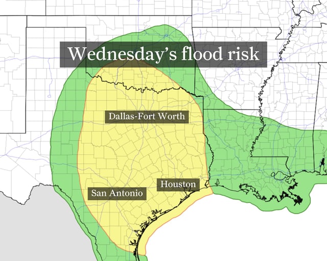
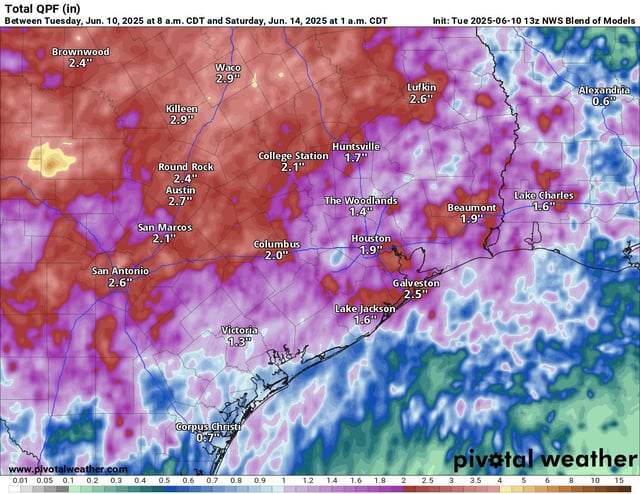
- The Weather Prediction Center has placed a broad swath from Dallas-Fort Worth to Houston under a Level 2 of 4 flash flood risk with 2–4 inches of rain forecast and up to 6 inches in isolated east-central Texas.
- A persistent moist low-level jet interacting with outflow boundaries will drive multiple rounds of showers and thunderstorms through Friday, keeping daily rain chances between 40 and 60 percent.
- Flood advisories are in effect across Central and South Texas as saturated soils raise the threat of rapid flooding, leading officials to warn drivers against traversing water-covered roads.