Overview
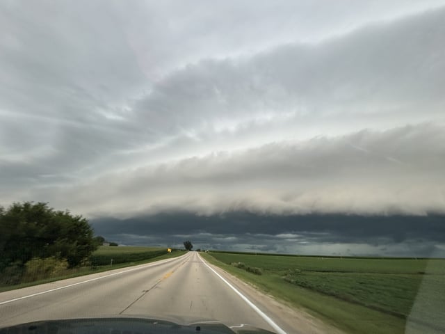
- Friday’s severe storm window, which spanned mid-afternoon to 11 p.m., prompted Tornado and severe thunderstorm watches across most of Chicagoland with threats of damaging winds, hail and flash flooding.
- The Tornado Watch issued by the National Weather Service at mid-afternoon expired at 11 p.m. Friday, officially ending the formal warning for rotating storms.
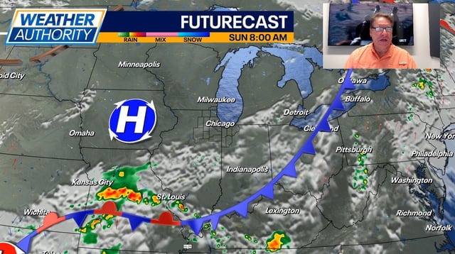
- High pressure will usher in mostly sunny skies and lower humidity on Sunday, with daytime highs in the low to mid-80s.
- Dew points are expected to fall into the 50s by Sunday afternoon, providing the region’s first significant break from muggier summer air since Friday.
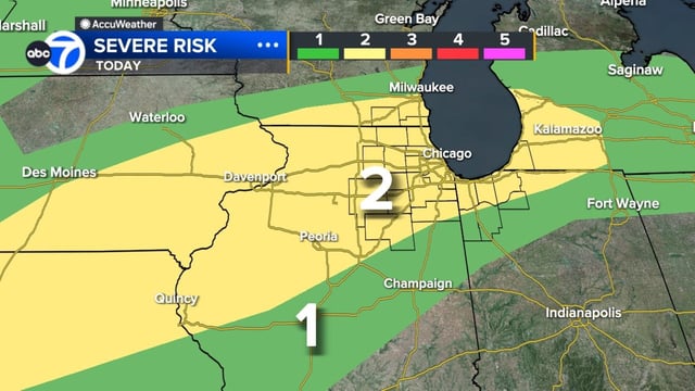
- Forecasters predict the next round of scattered strong to severe thunderstorms will arrive late Tuesday through Thursday as a summer cold front moves into northeastern Illinois.