
Overview
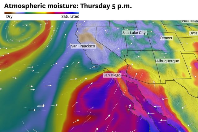
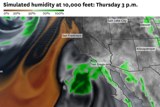
- Although no hazard alerts are posted, NWS San Diego expects increasing moisture with scattered showers from late Wednesday night through Thursday evening, along with a slight chance of thunderstorms.
- Urban areas could see 0.05 to 0.25 inches of rain and mountain locations up to 0.5 inch, with the greatest potential from San Diego to the Coachella Valley and a localized flash-flood risk in higher terrain.
- The bulk of the moisture is projected to stay south and east of Los Angeles County, though isolated showers remain possible there, according to the NWS Oxnard office.
- A southerly swell tied to Juliette is set to bring 3 to 6 feet of surf and stronger, more frequent rip currents at Southern California beaches on Thursday and Friday.
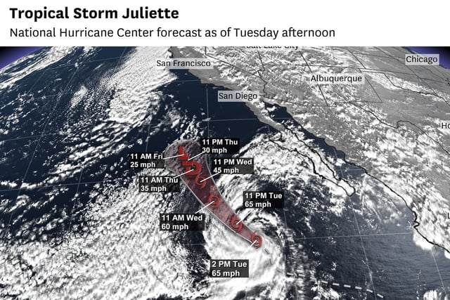
- The National Hurricane Center expects Juliette to dissipate by Thursday, with impacts tapering and warmer, drier conditions returning by Friday into the Labor Day weekend.