


Overview
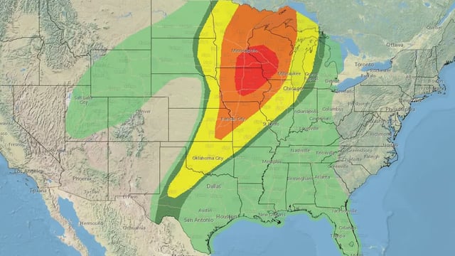
- The SPC's Day 3 Moderate Risk covers southeastern Minnesota, northeastern Iowa, and southwestern Wisconsin, marking the first such designation for the region since 2011.
- Forecasters predict two storm rounds: a morning hail event in northern/central Minnesota and afternoon supercells capable of intense tornadoes transitioning into an evening squall line.
- Over 50 million people are under severe weather alerts, with enhanced risk areas stretching from eastern Kansas to northern Minnesota and Michigan's Upper Peninsula.
- Key transportation routes, including Interstates 35, 80, and 90, and major airports like MSP and DSM, could face significant disruptions due to the storms.
- The severe weather system will continue eastward on April 29-30, bringing threats to central Texas and upstate New York.